
Site Created by Stephane Grounauer - june 2001
Last update: May 18, 2003
by Stephane Grounauer
|
C-11653 (Biosolids Project)
|
|
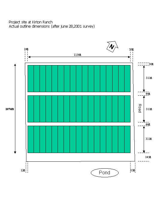
Surveyors: Stephane Grounauer / Thiago Silva (9am to 3pm / rented van, John and Carlos dropped at Buck Island) We checked the marks set last week, and their position related to the fence. In some points, particularly near the origin the position of the fence relative to the plots do not reflect the plans. We corrected the position of the plots to guarantee enough space for the tractor to access the plots as planned. The plans required 34 feet between the fence and the plots on the east side. The actual size of this space is now between 30 and 35 feet. To do this we had to reduce the space on the west side. The map "actual dimensions" shows the situation. Along the east and west fence we set a series of marks that allow the reconstruction of the blocks once the corner marks have been removed for the construction work. On the east fence the marks are set with a wood stake at ground level and a small pink survey flag. On the west side the points are set with 10' height 3/4" PVC pipes with a black flag. To allow the reconstruction of the origin point, the nearest to the entrance, two additional point were set in the ground with wood stakes at ground level. They show the position of the X and Y axis. |
|
|